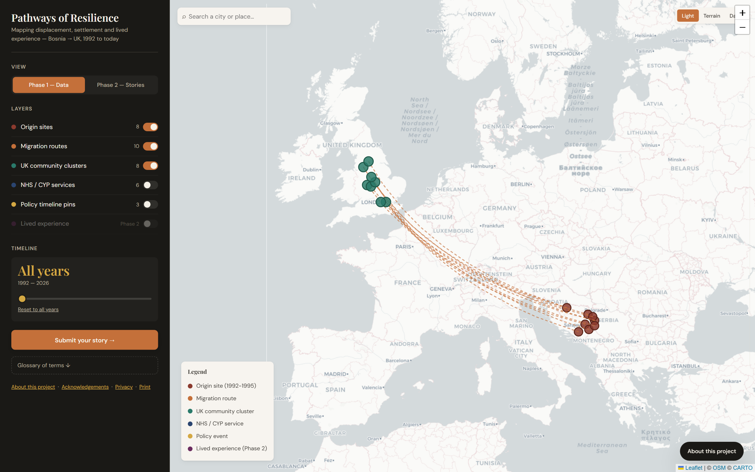
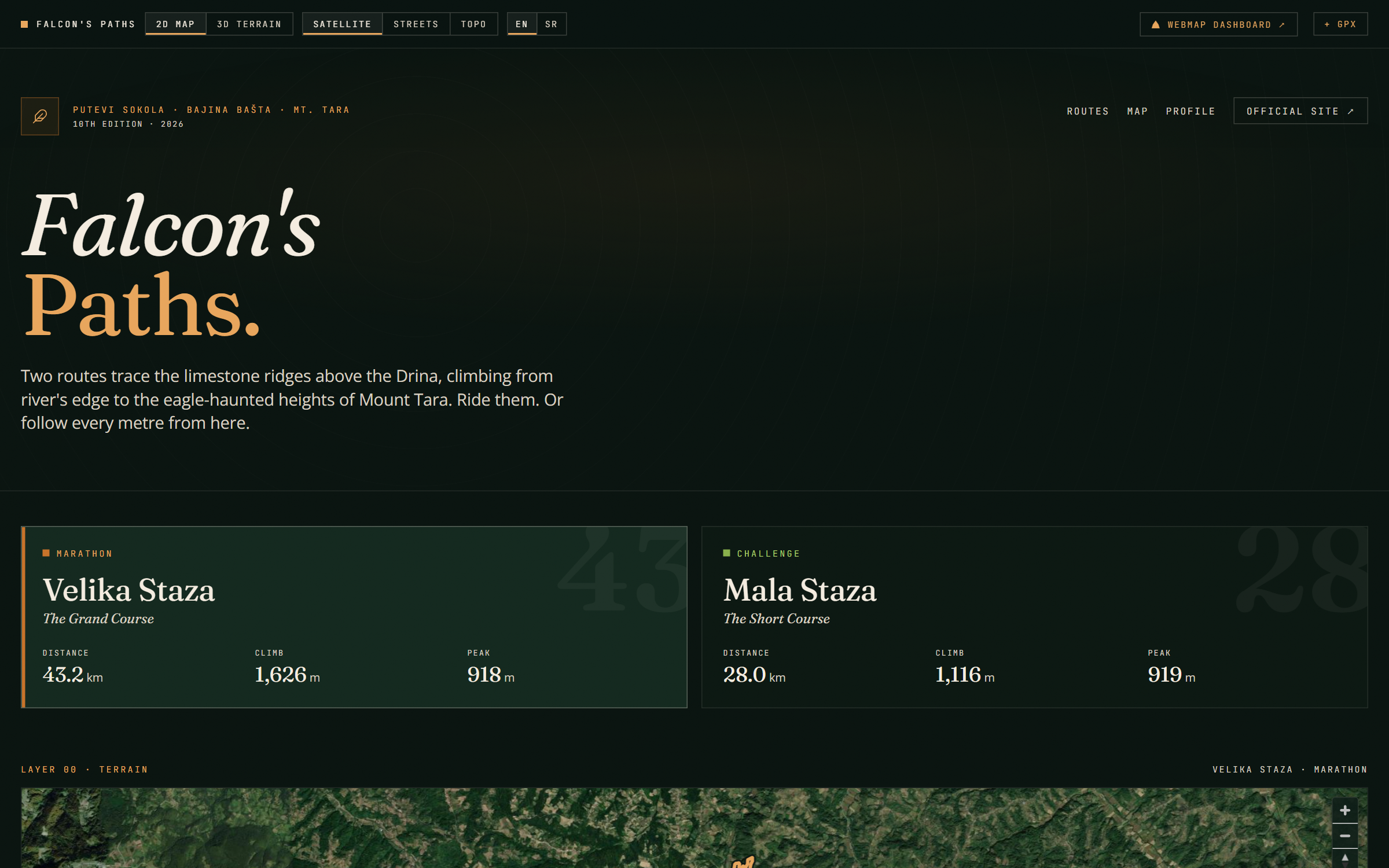
Geospatial & GIS
Web maps with MapLibre GL, Leaflet, Mapbox or OpenLayers. Spatial analysis with QGIS, PyQGIS, GeoPandas and GDAL. Drone survey processing. Satellite imagery analysis on Google Earth Engine. We bring real GIS rigour — CRS handling, projections, OS / OSM / ONS / Copernicus data — and ship it as something a non-technical user can operate.
Good for…
- Local authorities and planning consultancies
- Environmental and engineering teams
- Tourism boards and event organisers
- Research institutions and NHS commissioners
What you'll get
- 2-D and 3-D web maps (terrain, satellite, topographic basemaps)
- Spatial dashboards with charts, filters and per-layer controls
- Open-data integration (OS OpenData, OSM, ONS, Copernicus)
- Drone-survey deliverables (orthomosaics, DSM/DTM, GeoTIFF)
- Embeddable widgets and GPX/GeoJSON exports
Shipped examples
Real projects we've delivered in this category.
Geospatial & GIS by industry
Sector-specific geospatial & gis for our flagship UK industries.
Geospatial & GIS across the UK
BozApps delivers geospatial & gis in every major UK city. Pick your location for tailored detail.
- Geospatial & GIS in London
- Geospatial & GIS in Manchester
- Geospatial & GIS in Birmingham
- Geospatial & GIS in Edinburgh
- Geospatial & GIS in Leeds
- Geospatial & GIS in Bristol
- Geospatial & GIS in Glasgow
- Geospatial & GIS in Liverpool
- Geospatial & GIS in Newcastle
- Geospatial & GIS in Sheffield
- Geospatial & GIS in Nottingham
- Geospatial & GIS in Cardiff
- Geospatial & GIS in Belfast
- Geospatial & GIS in Cambridge
- Geospatial & GIS in Oxford
- Geospatial & GIS in Brighton
- Geospatial & GIS in Reading
- Geospatial & GIS in Southampton
- Geospatial & GIS in Leicester
- Geospatial & GIS in Coventry
Frequently asked questions
What map libraries do you use?
MapLibre GL JS by default — open source, no usage fees, smooth WebGL rendering. Mapbox GL JS when the client specifically needs Mapbox features. Leaflet for lightweight cases.
Do you work with OS, OSM and Copernicus data?
Yes. We integrate Ordnance Survey OpenData, OpenStreetMap, ONS statistics, Environment Agency data, Copernicus Sentinel imagery, and most open public-sector datasets. Field data from QField and Mergin Maps where the project includes survey work.
Can you handle drone-derived data?
Yes. The Bozmaps side of the studio handles drone capture, photogrammetry, and processing. The BozApps side wraps the deliverables in the dashboard or web tool.
Ready to scope geospatial & gis?
30-minute call. Written proposal within five working days. Fixed price wherever the scope allows.